THE NYSTROM ATLAS OF TEXAS HISTORY
Select your Materials
See all the ways you can bring this atlas in to your classroom by reading the description below.
PAPERBACK ATLAS
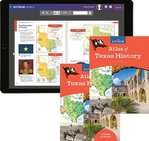
This first edition of The Nystrom Atlas of Texas History uses various approaches to teach about Texas in a new and exciting way by incorporating graphs, maps, charts, and images. The first two units cover political Texas, physical Texas, geographic diversity, and natural features. The subsequent nine units cover Texas history from first inhabitants to modern Texas. Correlated to TEKS standards.
Features:
- A "Using This Atlas" introduction
- Captioned, full-color maps and images labeled "A-B-C-D" that guide readers logically from idea to idea
- "Did you know" call-outs that introduce historical facts
- Three two-page spreads featuring notable Texans
- Physical and political maps of the world, the United States, and Texas
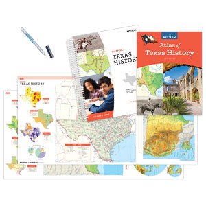
STUDENT ACTIVITY BOOK
Give students a richer experience of the Nystrom Atlas of Texas History with the 104-page Student Activities book. These reproducible handouts strengthen geography skills and content knowledge while developing critical-thinking and information-literacy skills. Intended for grades 4–7, written at an approachable level, and ELL-friendly.
ATLAS PACK
30 ATLASES, 1 STUDENT ACTIVITY BOOK, 5-YEAR E-ATLAS SUBSCRIPTION WITH ACTIVITIES
The Atlas Pack engages students and brings together the atlas, student activities, and digital platform together for a seamless curriculum.
E-ATLAS WITH INTERACTIVE ACTIVITIES: 5-year subscription
Support classroom, remote, and blended learning with a 5-year e-atlas subscription. You’ll have access to the Nystrom Atlas of Texas History flip-book, interactive activities, and the downloadable 104-page activity book, which includes reproducible handouts, answer keys, and literacy lessons to introduce and reinforce essential skills.
COMPLETE PROGRAM COMPONENTS
| Copyright | 2020 |
|---|---|
| Size | 8½" x 11" |
| Publisher | Nystrom |
| Pages | 104 |
| Grade | 4–7 |
| ISBN | 9780782526639 |


