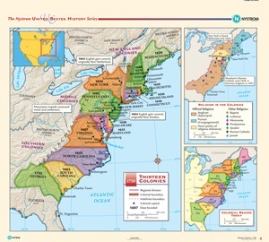
THIRTEEN COLONIES, 1750
Map on spring roller with backboard
Connect with a representative to create a custom curriculum for your district.
The main part of the map shows all the colonies, along with regional divisions, colonial boundaries, indefinite boundaries, colonial capitals, and the date when each state was founded. Insets show the distribution of religions in the colonies, and the states today that occupy the colonial regions shown on the map.
This title is part of the series: THE NYSTROM COMPLETE U.S. HISTORY MAP SET

