WORLD MAP
Study card
Connect with a representative to create a custom curriculum for your district.
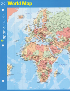
This map presents a Van der Grinten projection featuring Europe, Asia, Africa, and Australia on one side, North and South America on the other. Included are lines of latitude and longitude, national boundaries and capitals, and major cities, roads, and rivers.
This title is part of the series: SPARKCHARTS NOTEBOOK MAPS
| Copyright | 2014 |
|---|---|
| Size | 8½" x 11" (folds out to 16" x 11") |
| Publisher | Spark Publishing |
| ISBN | 9781411470965 |

